Sell or Auction Your John White Map of Virginia From 1590 for up to $6,665 or More at Nate D. Sanders Auctions
FREE APPRAISAL. To buy, auction, sell or consign your John White Map of Virginia From 1590 that is for sale, please email your description and photos to [email protected] of Nate D. Sanders Auctions (http://www.NateDSanders.com).
Sell Your John White Map of Virginia From 1590
Consign your item at Nate D. Sanders Auctions. Send a description and images of your item to us at [email protected].
Below is a John White Map of Virginia From 1590 we have sold in the past:
John White’s Map of Virginia From 1590 — The First Printed Map of Virginia and North Carolina
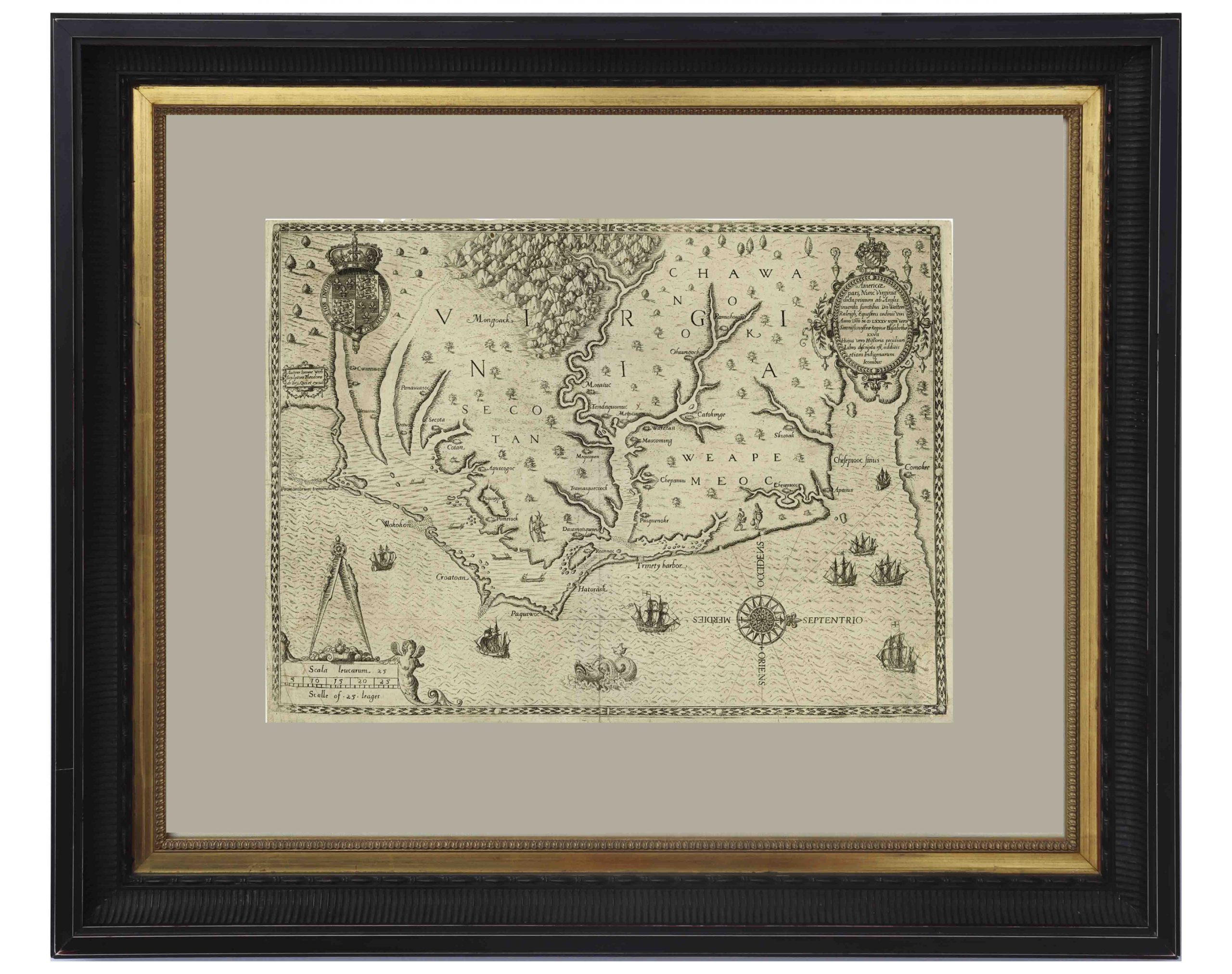
An important 16th century North American map known not only for its level of detail and accuracy, but also for its “firsts”: the first printed map of Virginia and North Carolina, the first to use Virginia in its title, the first to name the Chesapeake Bay, and also the first regional map showing the Roanoke Colony. Frankfurt: Theodor de Bry (engraver) for inclusion in his “Anglorum in Virginiam aduentus”, 1590.
Map is based on the work of cartographer, artist and explorer John White, one of the first settlers and Governor of the Roanoke Colony who, after sailing back to the Colony from England in 1587, had found all the colonists famously missing, their fate a mystery still unsolved. Philip Burden, who wrote the definitive reference book, “The Mapping of North America”, wrote of this map: “One of the most significant cartographical milestones in colonial North American history…the most accurate map drawn in the sixteenth century of any part of that continent.”
This full-sheet engraved map still retains its dark print, with the English Royal Arms at top left, and artistic touches throughout such as ships and sea monsters in the open ocean, and Native American canoeists in the inland waters. Map is the second state, with “C” laid over the “E” in Ehesepiooc. Map measures 16.675″ x 12.25″, nicely matted and framed to a size of 28″ x 23.5″. Expert repair to single vertical fold, and small area of repair to lower right corner, just touching the edge of the ship, where paper loss has been replaced. Overall in very good to near fine condition given age, displaying beautifully. Sold for $6,665.
Consign your item at Nate D. Sanders Auctions. Send a description and images of your item to us at [email protected].
FREE APPRAISAL. To buy, auction, sell or consign your item that is for sale, please email your description and photos to [email protected] of Nate D. Sanders Auctions (http://www.NateDSanders.com).