Sell or Auction Your Alonso de Ovalle Historica Relacion Del Reyno de Chile Folding Map 1646 for Nearly $20,000 or More at Nate D. Sanders Auctions
FREE APPRAISAL. To buy, auction, sell or consign your Alonso de Ovalle Historica relacion del reyno de Chile folding map 1646 that is for sale, please email your description and photos to [email protected] of Nate D. Sanders Auctions (http://www.NateDSanders.com).
Sell Your Alonso de Ovalle Historica Relacion Del Reyno de Chile Folding Map 1646
Fr. Alonso de Ovalle (Santiago; July 27, 1603 – Lima; May 1651) was a Chilean Jesuit priest and chronicler of Chilean history, author of the Historica relacion del Reyno de Chile y de las missiones y ministerios que exercita en él la Compañía de Jesus, describing the Conquest of Chile and the Arauco War. He was great grandson of the Genoese sailor Juan Bautista Pastene.
Below is a recent realized price for an Alonso de Ovalle Historica relacion del reyno de Chile folding map 1646 item. We at Nate D. Sanders Auctions can obtain up to these amounts or more for you:
Alonso de Ovalle Historica Relacion del Reyno de Chile Folding Map 1646. Sold for nearly $20,000.

Here are some recent items that our auction house, Nate D. Sanders (http://www.NateDSanders.com) has sold:
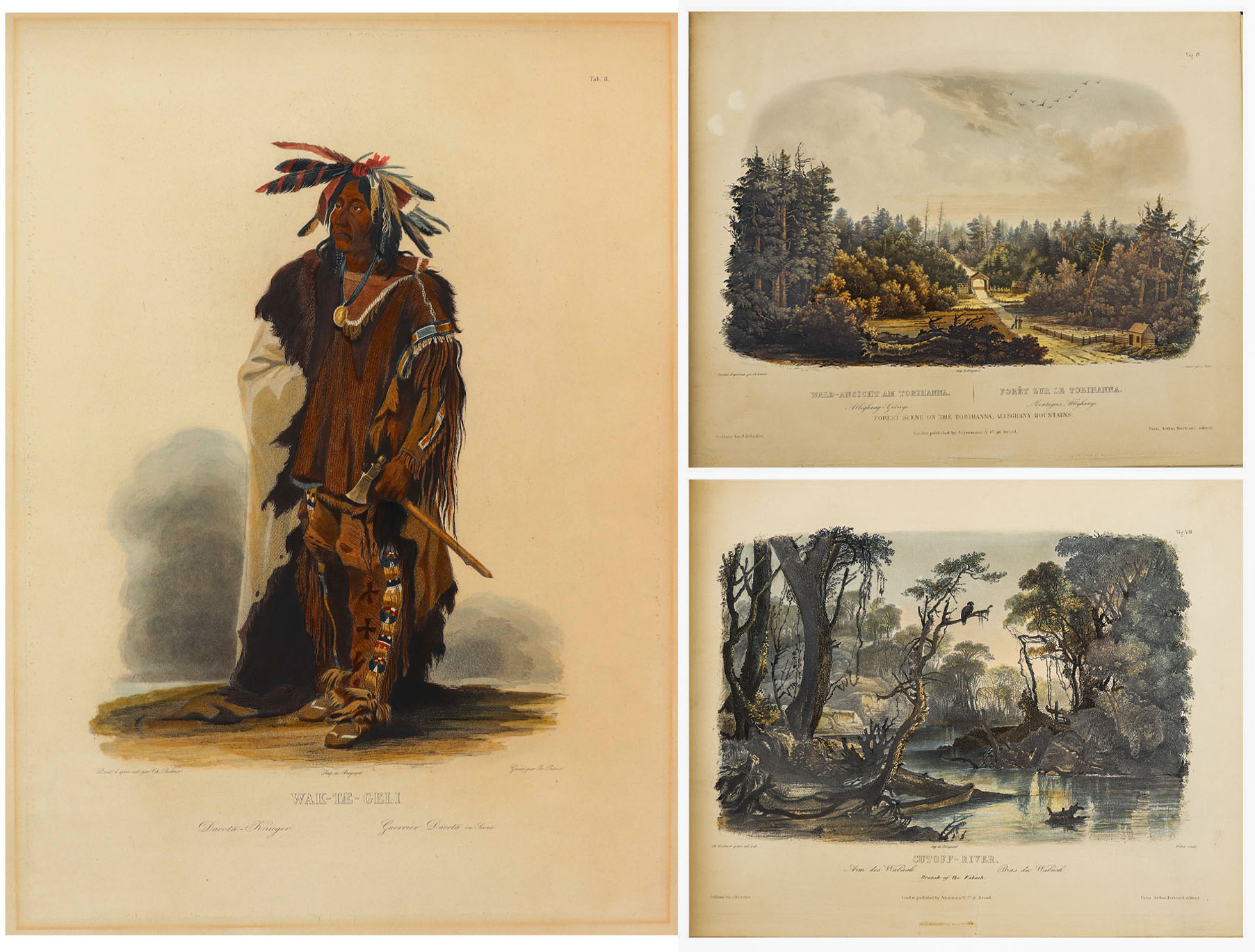
Karl Bodmer Prince of Wied’s Travels in the Interior
Stunningly beautiful collection of 81 hand-colored aquatints by the Swiss artist Karl Bodmer, a complete collection from the illustrated travelogue, “Prince of Wied’s Travels in the Interior of North America”. Bodmer, who journeyed with the German Prince Maximilian of Wied-Neuwied from 1833-34 along the Missouri River, produced what is considered the best depictions of the indigenous peoples and landscapes during the frontier era, an America then still unspoiled by western migration. Of the Native American tribes of the Great Plains that they encountered, Bodmer’s depictions of the Blackfeet and Mandan tribes are especially important as the populations of these tribes were greatly affected by the smallpox epidemic of 1837, thus making Bodmer’s work the last visual testament to their culture.
Prince Max, as he was called, chose Bodmer to accompany him on the expedition along the Missouri River to visually depict the scenes that the Prince would write about. The result is this collection: three volumes of text by the Prince and two volumes of aquatints by Bodmer, in the first Paris edition published by Chez Arthus Bertrand, 1840-43 (“Voyage dans l’interieur de l’Amerique du Nord”). Text volumes in French also include 37 wood-engraved illustrations, only lacking the map in completeness. The two complete volumes of illustrations include the large folio volume with 48 oversized hand-colored aquatints measuring approximately 24.5″ x 18″, and the quarto volume with 33 hand-colored aquatints measuring approximately 12.5″ x 10.25″. The complete set of 81 aquatints is magnificent in their display, a time capsule with their hand-coloring evoking the sense of awe and discovery of the expedition. All volumes are bound in half black morocco and blue paper-covered boards with gilt accenting, and with black morocco labels to illustrated volumes. Minor handling wear to volumes, with a few small repaired tears to plates, some plates supplied with variance to margins, minute toning and foxing, a few plates beginning to separate from binding. Overall a very good plus set with excellent display quality. Sold for $175,000.


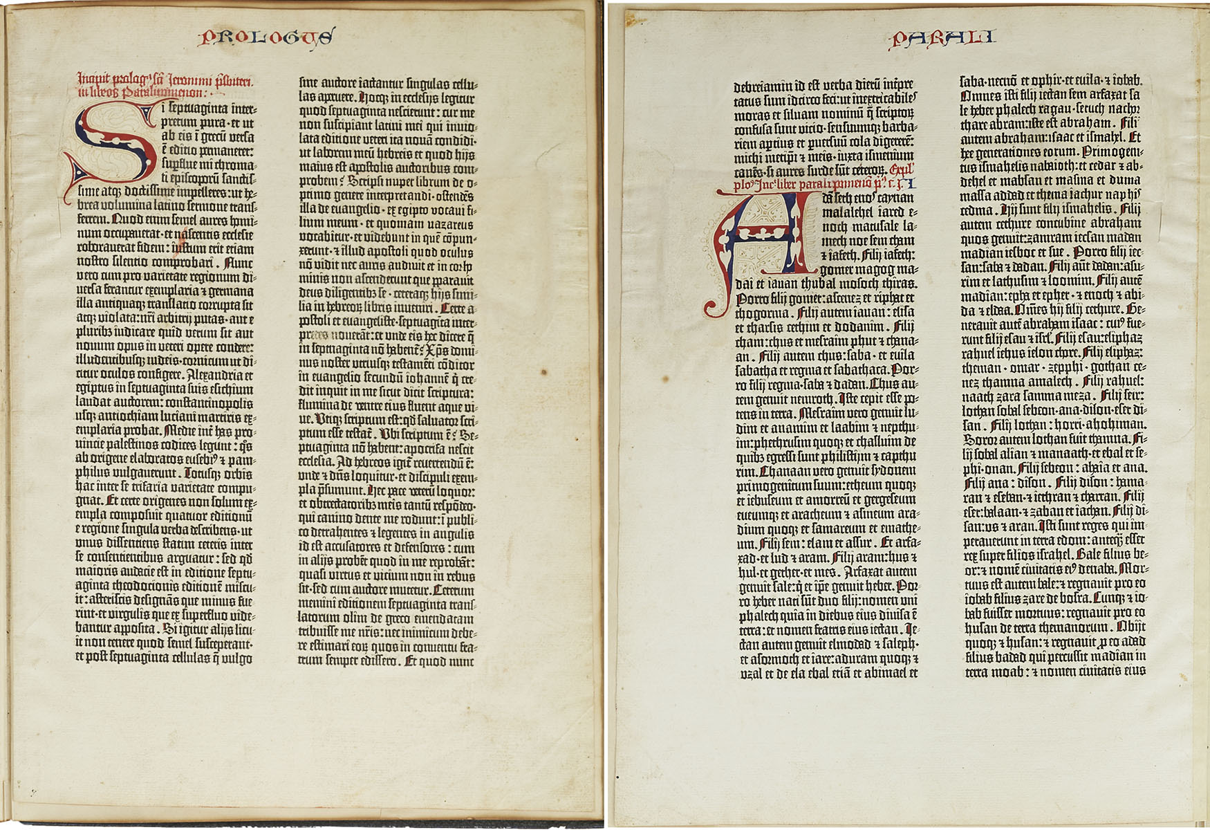
Gutenberg Bible Leaf 193 Chronicles of Old Testament
Scarce leaf from the Gutenberg Bible, one of the earliest major books printed from moveable metal type, the invention that ushered in the Age of Enlightenment by democratizing knowledge through mass production of literature. Printed by Johannes Gutenberg in Mainz, Germany from 1450-1455, less than 50 complete or near-complete copies of the Gutenberg Bible are now extant, with nearly all those housed in public institutions. Singular leaves are also scarce, with the leaf presented here having been acquired by bookseller Gabriel Wells, whose purchase of an incomplete Bible in 1920 gave way to selling the individual leaves alongside an essay by A. Edward Newton entitled “A Noble Fragment”. Leaf is number 193 of the full Latin Bible, with the recto being the Prologue to 1 Chronicles of the Old Testament, and the verso the first part of Chapter 1 of 1 Chronicles. Each page features two columns of 42 lines in dark black Gothic type, accented by red and blue rubrication. Each copy of the Gutenberg Bible differs in its rubrication and illumination, with buyers at the time deciding upon these embellishments after the Bible was printed. The six-line rubricated letters of this leaf were likely added later, restored to match the original style. Leaf measures 11.125″ x 15.375″, bound on edge to portfolio measuring 11.75″ x 16″. Paper quality is still bright with very little foxing or discoloration compared to other examples. A stunning example from the book that changed the course of history. Sold for $136,500.
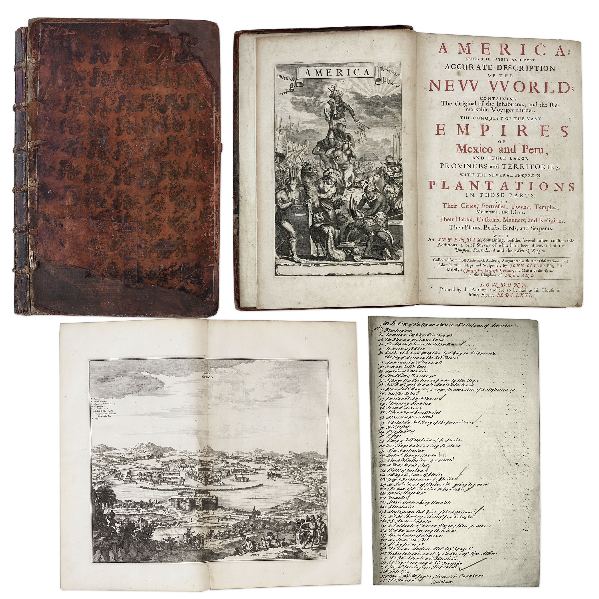
One of the most important books on the history of America (cited by Borba de Moraes, Howes, Sabin and Wing), the 1671 first edition of ”America: Being the Latest and Most Accurate Description of the New World”. Privately printed in London by the author, Arnoldus Montanus, and edited by John Ogilby. In ”America” Montanus goes into great detail of the new continents, with dozens of engravings of Native Americans, species of animals and reptiles, and the landscapes and settlements in the new world, accompanied by text. The book covers speculation regarding the earliest voyages to America, along with later recorded voyages and the settlements of New Netherlands/New York, New England, Hudson’s Bay, Labrador, Canada, Nova Scotia, Maryland, Virginia, (including Captain Smith’s capture and rescue by Pocahontas), Carolinas, Florida and California, plus accounts of Mexico and nearby islands, even including Australia and New Zealand. 674pp. book contains 75 original engravings (64 copper plates within the text and 9 plates throughout), lacking the maps and 28 engravings, which is typical as this edition is almost never found with all plates intact. All text is complete except for missing pages 445-446. Large format book measures 10” x 15”. Bound in original full leather boards, with some loss of leather to covers, cracking along spine and front board detached. Interior text is near fine and very readable. An important and fascinating addition to early knowledge of the American continent. Sold for $9,375.
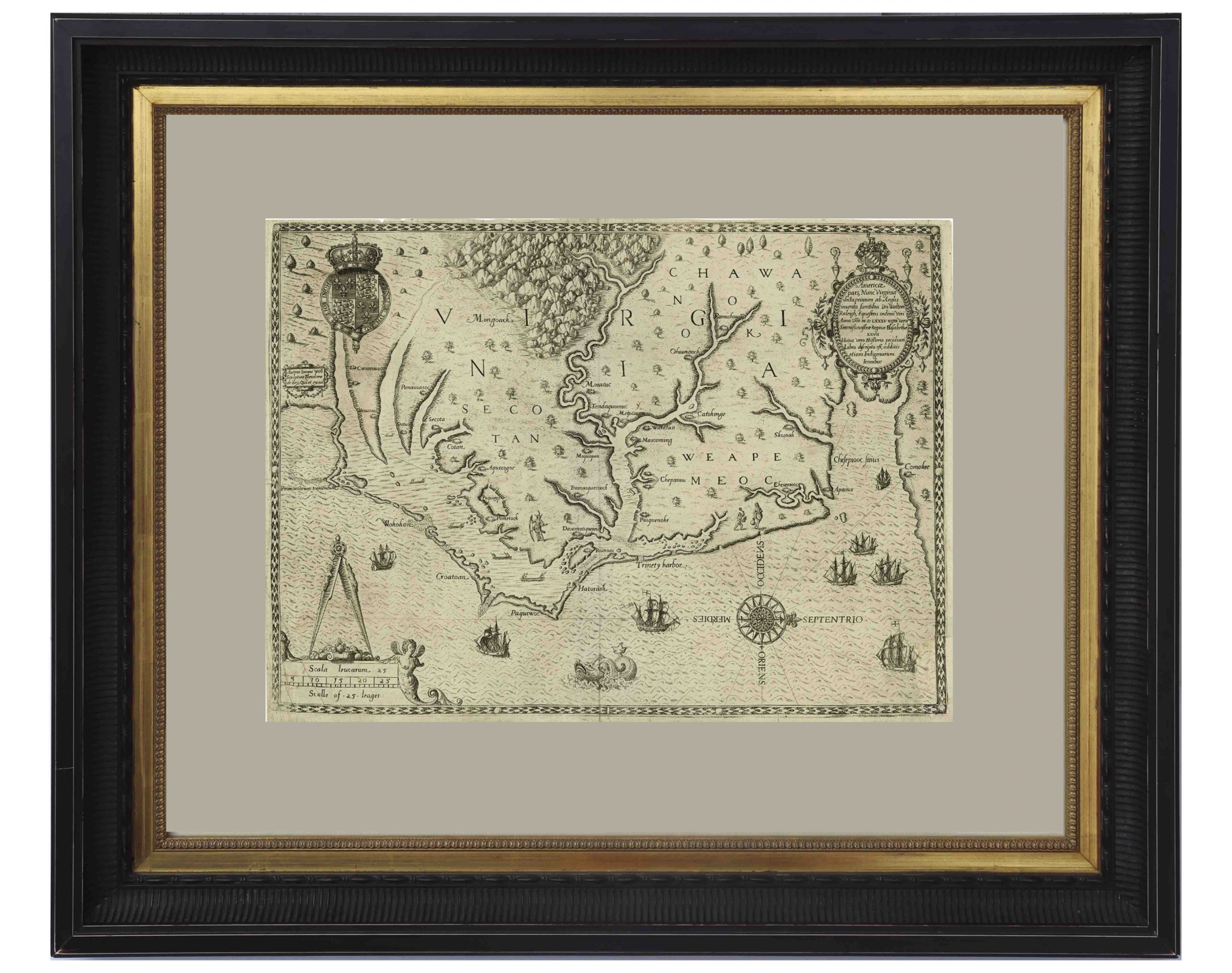
John White’s Map of Virginia From 1590 — The First Printed Map of Virginia and North Carolina
An important 16th century North American map known not only for its level of detail and accuracy, but also for its “firsts”: the first printed map of Virginia and North Carolina, the first to use Virginia in its title, the first to name the Chesapeake Bay, and also the first regional map showing the Roanoke Colony. Frankfurt: Theodor de Bry (engraver) for inclusion in his “Anglorum in Virginiam aduentus”, 1590.
Map is based on the work of cartographer, artist and explorer John White, one of the first settlers and Governor of the Roanoke Colony who, after sailing back to the Colony from England in 1587, had found all the colonists famously missing, their fate a mystery still unsolved. Philip Burden, who wrote the definitive reference book, “The Mapping of North America”, wrote of this map: “One of the most significant cartographical milestones in colonial North American history…the most accurate map drawn in the sixteenth century of any part of that continent.”
This full-sheet engraved map still retains its dark print, with the English Royal Arms at top left, and artistic touches throughout such as ships and sea monsters in the open ocean, and Native American canoeists in the inland waters. Map is the second state, with “C” laid over the “E” in Ehesepiooc. Map measures 16.675″ x 12.25″, nicely matted and framed to a size of 28″ x 23.5″. Expert repair to single vertical fold, and small area of repair to lower right corner, just touching the edge of the ship, where paper loss has been replaced. Overall in very good to near fine condition given age, displaying beautifully. Sold for $6,665.
Revolutionary War Map 1776
Revolutionary War map dated March 1776. “The Theatre of War in North America, With the Roads and a Table of the Distances…” Printed in London for R. Sayer and J. Bennett. Map depicts the area east of the Mississippi River from James Bay to Cape Canaveral, and locates provincial boundaries, towns, forts, roads, Indian villages, New England fishing waters, and the like. An inset is comprised of “Evan’s Polymetric Table of America,” which allows one to calculate the distance between most of the prominent towns. Text below the map reads, “A Compendious Account of the British Colonies in North America,” which devotes a paragraph of description to each of the North American colonies, including Florida, Canada, and the Province of Quebec. Issued separately by Sayer and Bennett, who also published “the American Military Pocket Atlas,” that year for the use of British officers. A notable map of the American Revolution, published the same year as the American Declaration of Independence. 20.75″ x 28.5″; 29.25″ x 37.5″ framed. Excellent condition. Sold for $6,000.

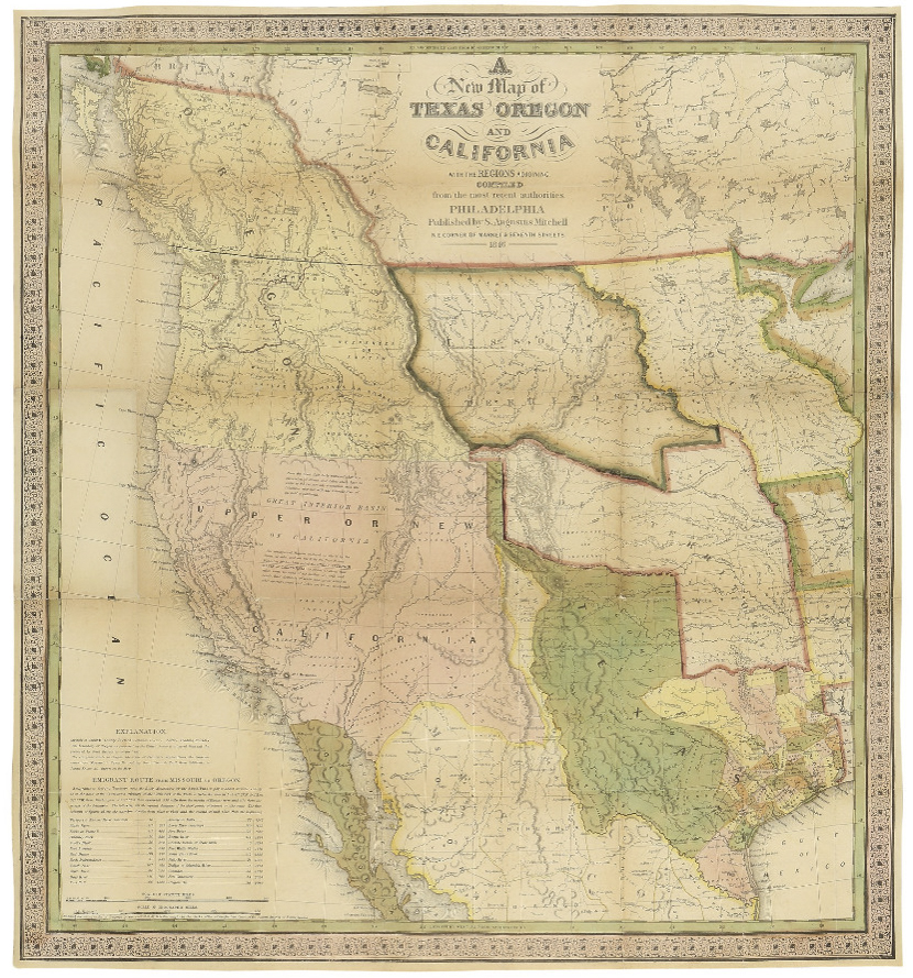
Map of Texas, Oregon and California From 1846
“A New Map of Texas Oregon and California with the Regions Adjoining. Compiled from the most recent authorities.” By cartographer Samuel Augustus Mitchell, published in 1846 as a pocket map, and considered the definitive map for settlers in the nation’s westward expansion during the Gold Rush. Philadelphia: Published by S. Augustus Mitchell, 1846. With contemporary hand-coloring, folding map by engraver H.N. Burroughs was Mitchell’s most important map, considered the defacto standard and thereby affecting subsequent maps of the area. It was the first to include recent explorations in the Great Basin, with boundary lines of Rio Grande to the south, and Oregon to the north at 54 degrees 40 minutes, above which are “British Possessions”. An inset to lower left entitled “Emigrant Route from Missouri to Oregon”, provides the distance between western cities and landmarks, undoubtedly aiding weary travelers. With decorative scrollwork along the margins, map measures 21″ x 22.5″ unfolded, nicely matted and framed to a size of 34.5″ x 41.5″. Some expert repair at fold separations and mild fading, overall in very good condition. Sold for $4,800.
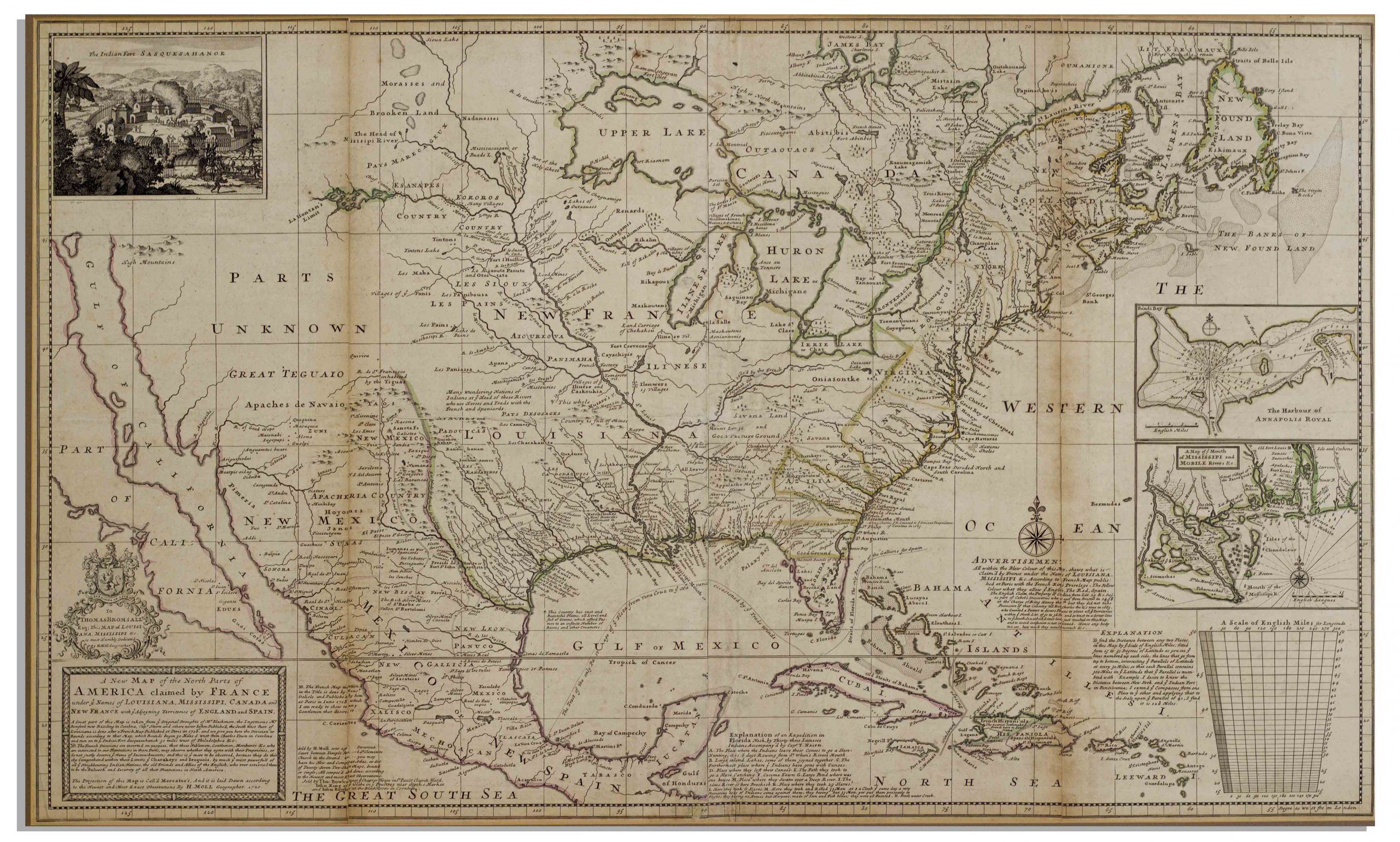
Herman Moll New Map of the North Parts of America
Large map of the Americas, published in 1720 by London cartographer Herman Moll entitled “A New Map of the North Parts of America claimed by France under ye names of Louisiana, Mississipi, Canada and New France with ye adjoyning territories of England and Spain”. Engraved map incorporates the latest surveying of the Americas, such as a French expedition into Texas in 1716. Map is hand-colored at boundaries, featuring a vignette at upper left of “The Indian Fort Sasquesahanok”, and with various “Explanations” of the map printed at bottom, including one of an Indian expedition into Florida, “6 days Rowing”. Insets of the Annapolis Harbor and the mouths of the Mississippi and Mobile Rivers are also included. Map is published in four vertical sections, laid down on archival paper and mounted on board. Map measures 25″ x 40.75″. Minor browning at section lines and a few spots of buckling. An attractive map in very good condition, giving historical insight into the jockeying for land among the major European powers in the early 18th century. Sold for $3,200.
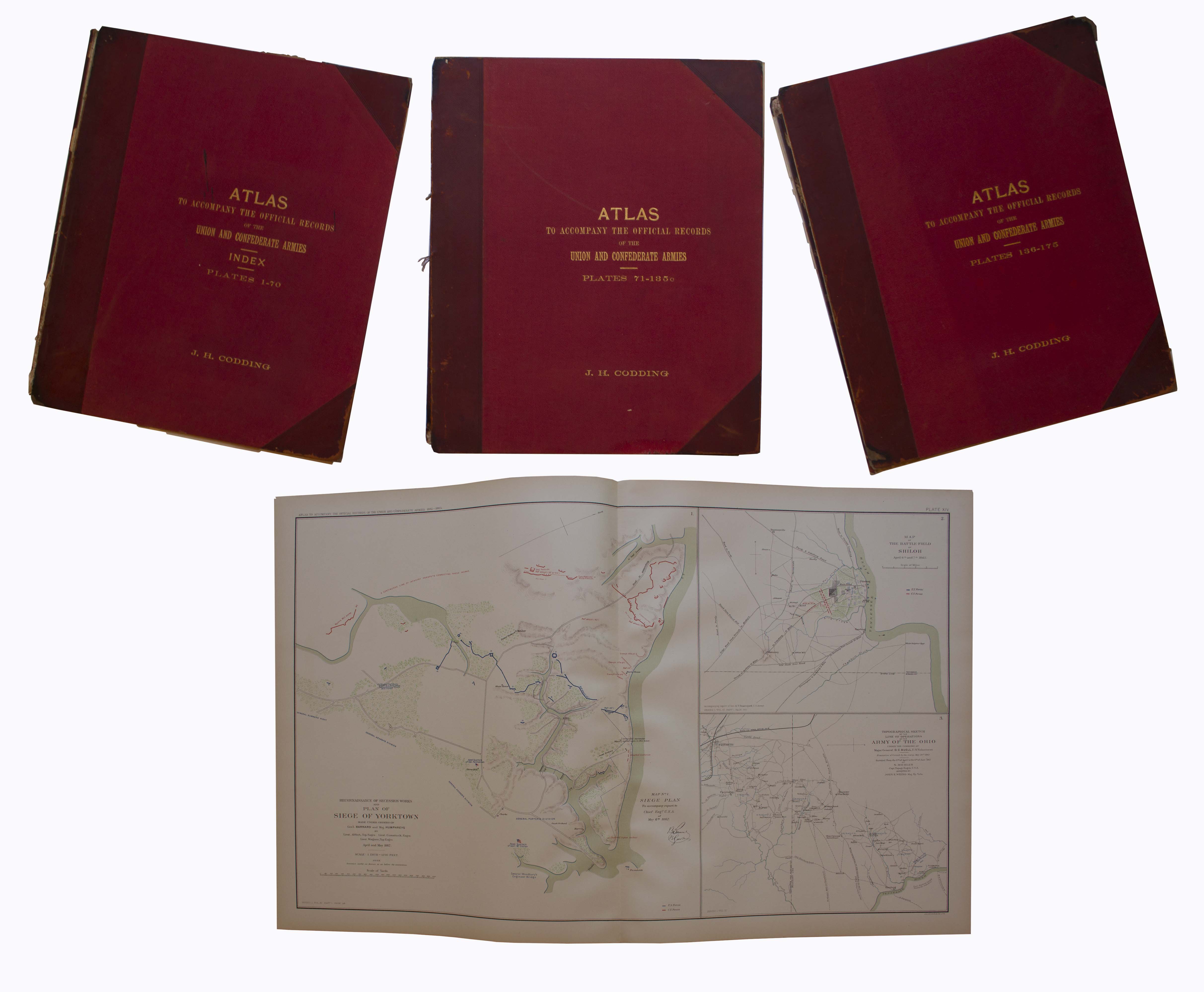
Three volume set of the ”Atlas to Accompany the Official Records”, compiled by Capt. Calvin D. Cowles. Washington, D.C.: U.S. Government Printing Office, 1891-1895. This three volume set of maps and drawings was printed to accompany the most comprehensive primary reference for the Civil War: ”War of the Rebellion: Official Records of the Union and Confederate Armies”, published by the U.S. Government in 53 volumes. All 175 plates are present here, with detailed schematics of battlegrounds, troop movements, examples of uniforms, transportation methods etc. Set is bound in original three-quarter red leather and maroon cloth, with marbled endpapers. Separated front board on Vols. 1 and 2, scuffing to boards and some loss to leather of spines, especially on Vol. 1. Maps and drawings, however, are in very good to near fine condition, with virtually no toning. Sold for $2,000.
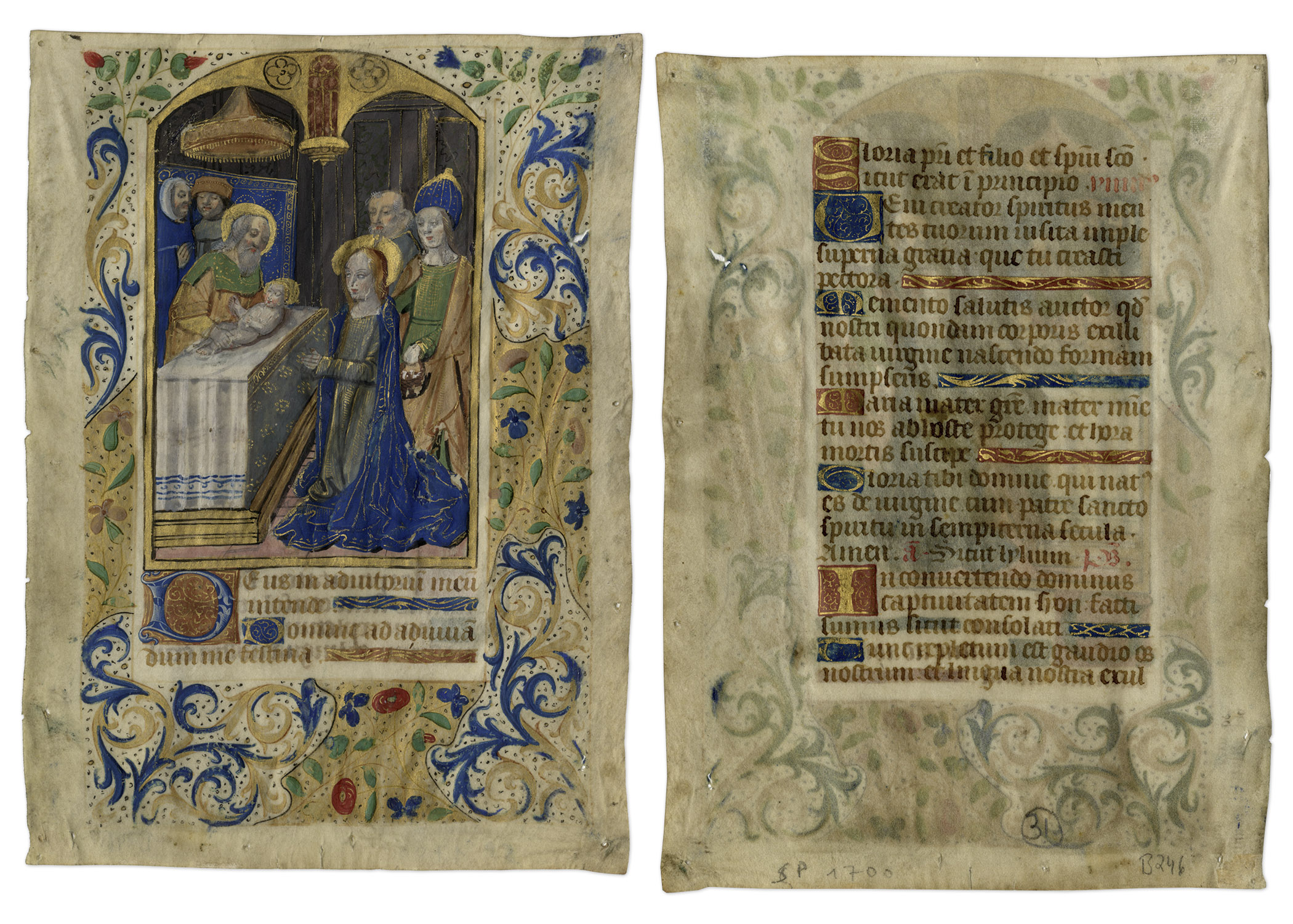
15th Century Hand-Painted Manuscript Page From “Book of Hours” — Illustrates Presentation of Jesus Christ
Hand-painted manuscript page from the liturgical text “Book of Hours”, from Paris, circa 1490. Front of double-sided page illustrates a scene from the presentation of Jesus Christ, who was circumcised on the 8th day after his birth. Includes 3/4 colored acanthus and floral border. Verso has single column with 22 lines of Latin text. Page is made of virgin-vellum and measures 4.25″ x 6″. Near fine condition given age. Sold for $1,469.
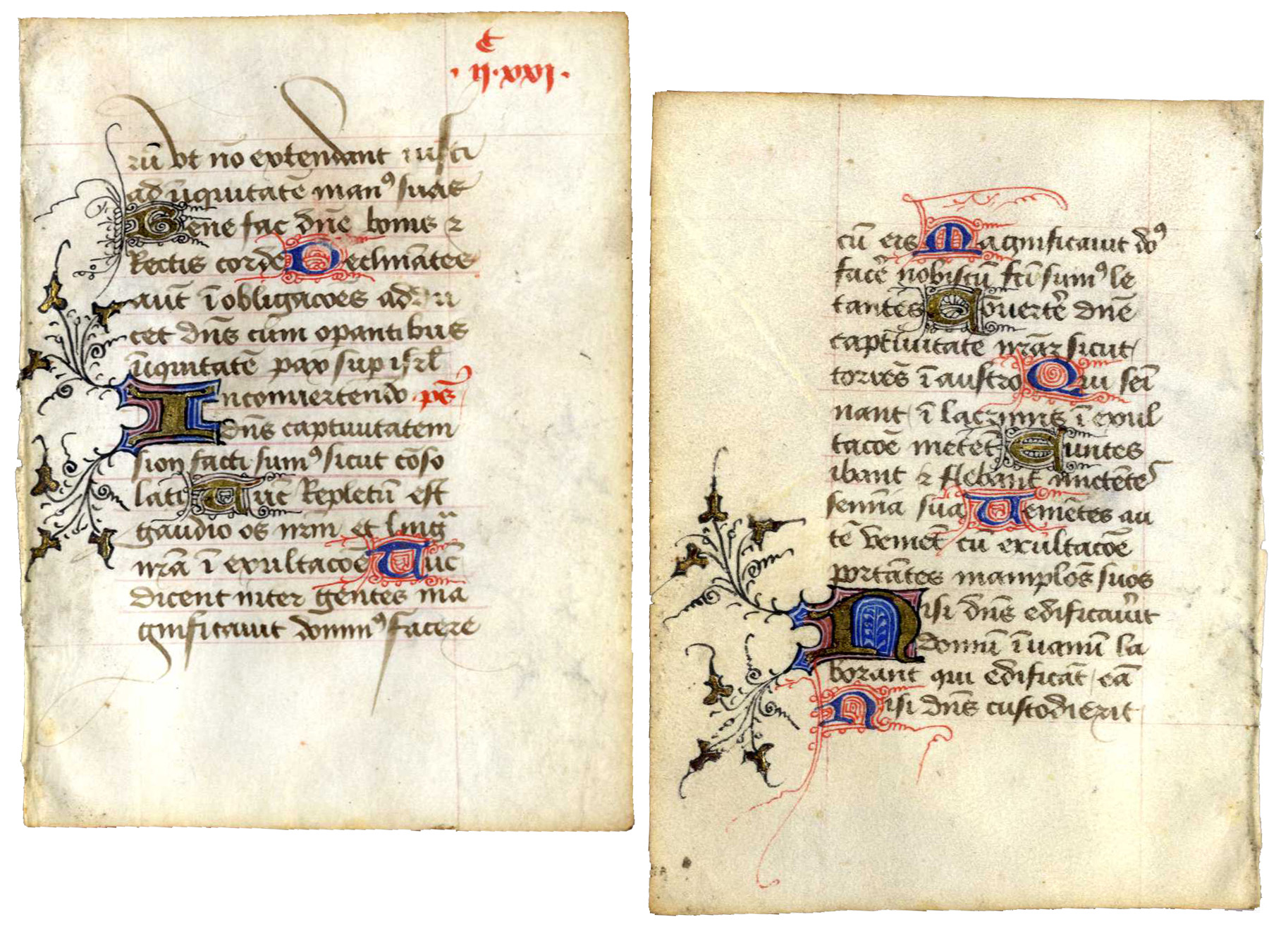
12th Century Hand-Painted Manuscript From ”Book of Hours”
Hand-painted manuscript page from the liturgical text ”Book of Hours”, from Tours in northern France, circa 1250. Double-sided page is beautifully rubricated in bright gold, blue and red. Single columns on each side contain 15 lines of Latin text. Page is made of virgin-vellum and measures 3.5” x 5”. Some rippling to bottom center, minor discoloration to edges and some foxing. Near fine given age. Sold for $1,250.
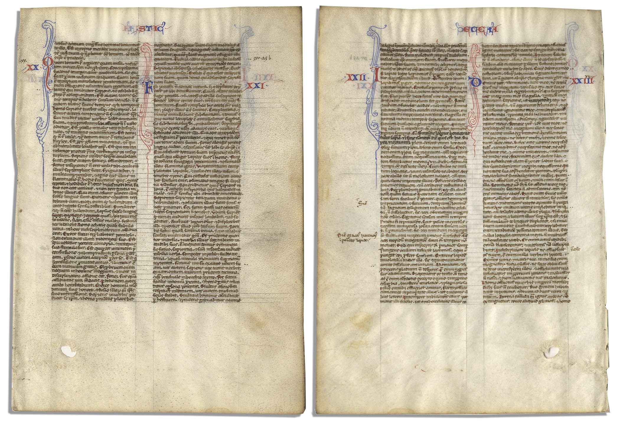
Bible Leaf From the Medieval Age, Circa 1250-1275 — Crusades Era Document on Vellum
Miniature medieval Bible page. Illuminated manuscript Bible page on vellum dates to the mid 13th century when pocket size Bibles were a common means of spreading Christianity to remote areas. Tiny Gothic script in Latin appears in brown ink with red and blue rubrication. Features a total of 56 lines of text, beginning with Ecclesiasticus (Sirach) 20:1 and running through 23:22. Translates in part, ”How much better is it to reprove, than to be angry, and not to hinder him that confesseth in prayer…The slipping of a false tongue is as one that falleth on the pavement: so the fall of the wicked shall come speedily…Flee from sins as from the face of a serpent: for if thou comest near them, they will take hold of thee. The teeth thereof are the teeth of a lion, killing the souls of men…The mourning for the dead is seven days: but for a fool and an ungodly man all the days of their life…” Thin sheet features text on both sides. Measures 4.25” x 6”. Hole in the margin at lower right is likely from original stretching. Very slight buckling to top edge. Near fine given age. Sold for $1,100.
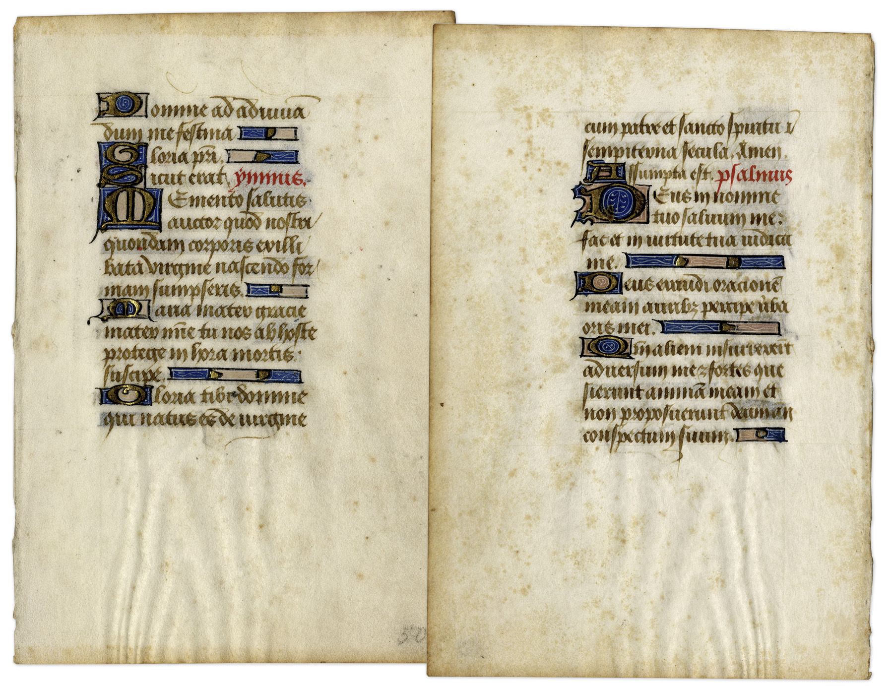
Illuminated Leaf From 15th Century French Psalm Book
Beautiful leaf from a 15th century French Book of Psalms. Fifteen lines of rubricated and gilt text appear on each side of the vellum leaf, written in a Gothic script. These illuminated leaves were created in the middle ages by artist scribes, who wrote in extraordinary detail, embellishing the text with gold, red and blue dyes. Because of the labor involved, the books were quite expensive at the time, and individual leaves have since been collected as works of art. Leaf measures approximately 3″ x 4″. Light toning, else near fine. Sold for $756.
Consign your Alonso de Ovalle Historica relacion del reyno de Chile folding map 1646 at Nate D. Sanders Auctions. Send a description and images of your Alonso de Ovalle Historica relacion del reyno de Chile folding map 1646 to us at [email protected].