Sell or Auction A New Description of Carolina Map for up to $1,850 or More at Nate D. Sanders Auctions
FREE ESTIMATE. To buy, auction, sell or consign your A New Description of Carolina map that is for sale, please email your description and photos to [email protected] of Nate D. Sanders Auctions (http://www.NateDSanders.com).
Sell A New Description of Carolina Map
Consign your item at Nate D. Sanders Auctions. Send a description of your item and images of your item to us at [email protected].
Here is a New Correct Map North America West India Islands item we have sold in the past:
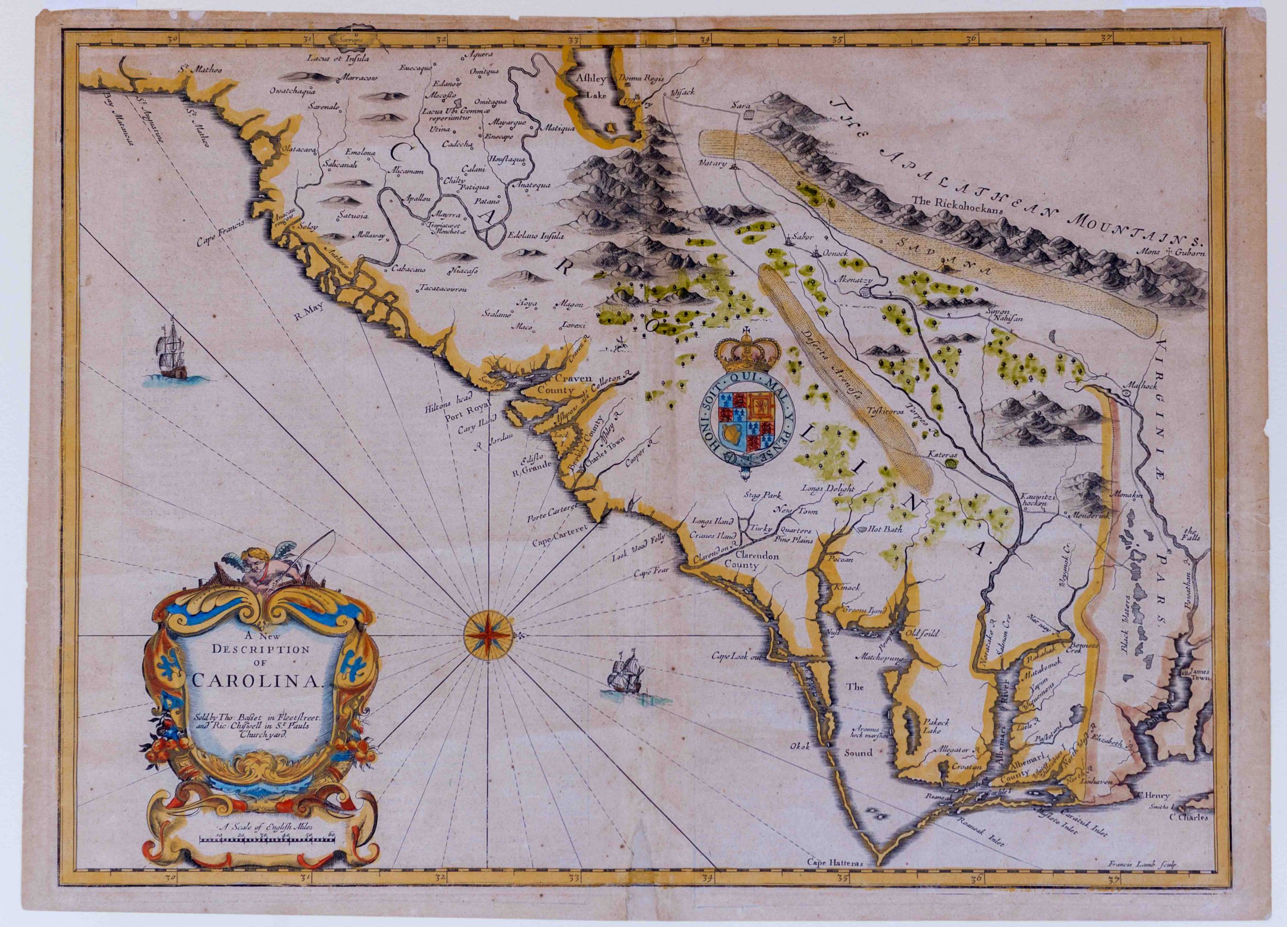
John Speed New Description of Carolina 1676 Map
Colorful map by cartographer Francis Lamb from 1676 of the Carolina coastline, extending from Jamestown, Virginia in the north to Matanzas Bay, Florida in the south. London: Basset and Chisswell, 1676, from the reissue of John Speed’s atlas, “The Theatre of the Empire of Great Britaine”, with new maps of the English colonies. With west oriented at top, map is entitled “A New Description of Carolina”, based on the work of explorer John Lederer, who ventured into the Carolinas along the edge of the Blue Ridge Mountains in 1670. Originally leading a group of 25 men, Lederer and his Susquehannock guide Jackzetavon pushed on after 21 of the men retreated. With English text on verso regarding the expeditions to the Carolinas and Florida. Double-page engraved map measures 21.25″ x 15.5″, hinged at top to mat measuring 26.375″ x 21.375″. Small spot of infill to bottom center, one tape repair to verso and minute foxing. In very good to near fine condition. Sold for $1,850.
Consign A New Description of Carolina map at Nate D. Sanders Auctions. Send a description of your item and images of your item to us at [email protected].